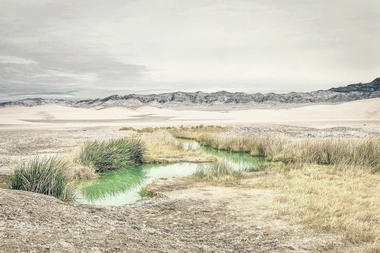
41.3566 N -118.7887 W Pinto Hot Springs, Great Basin, NV
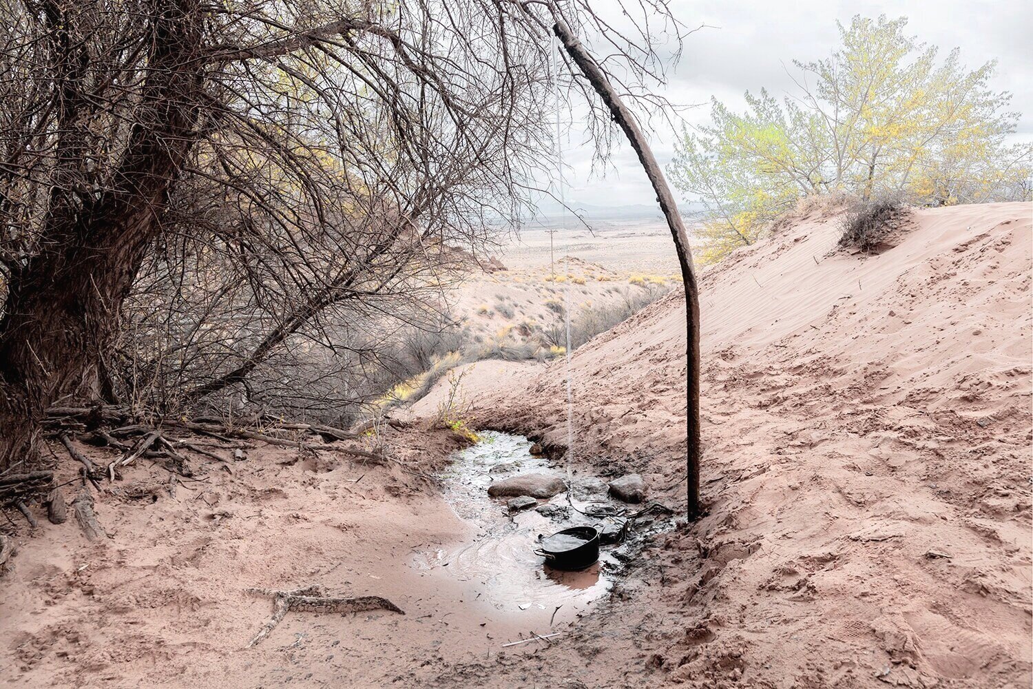
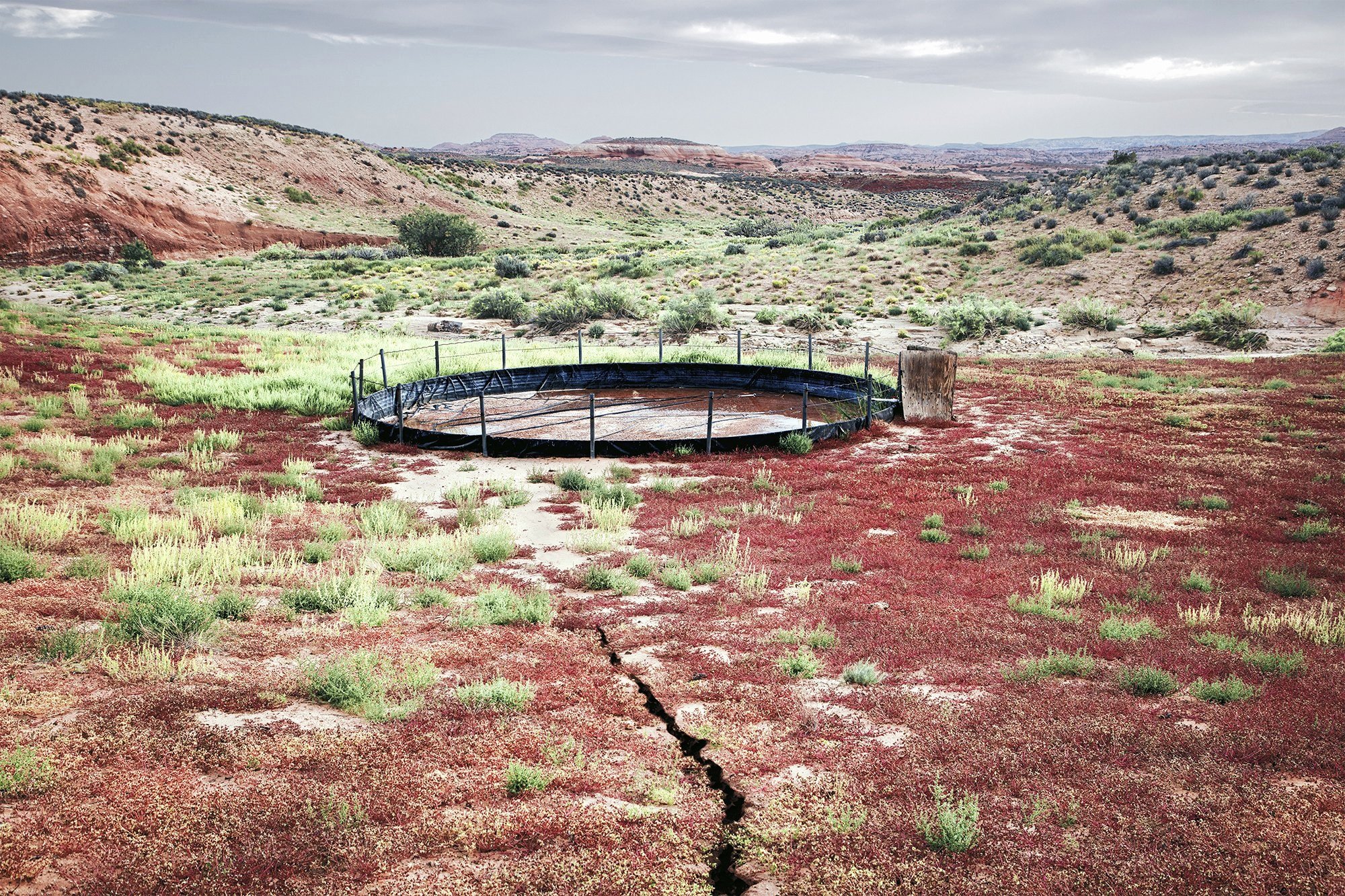
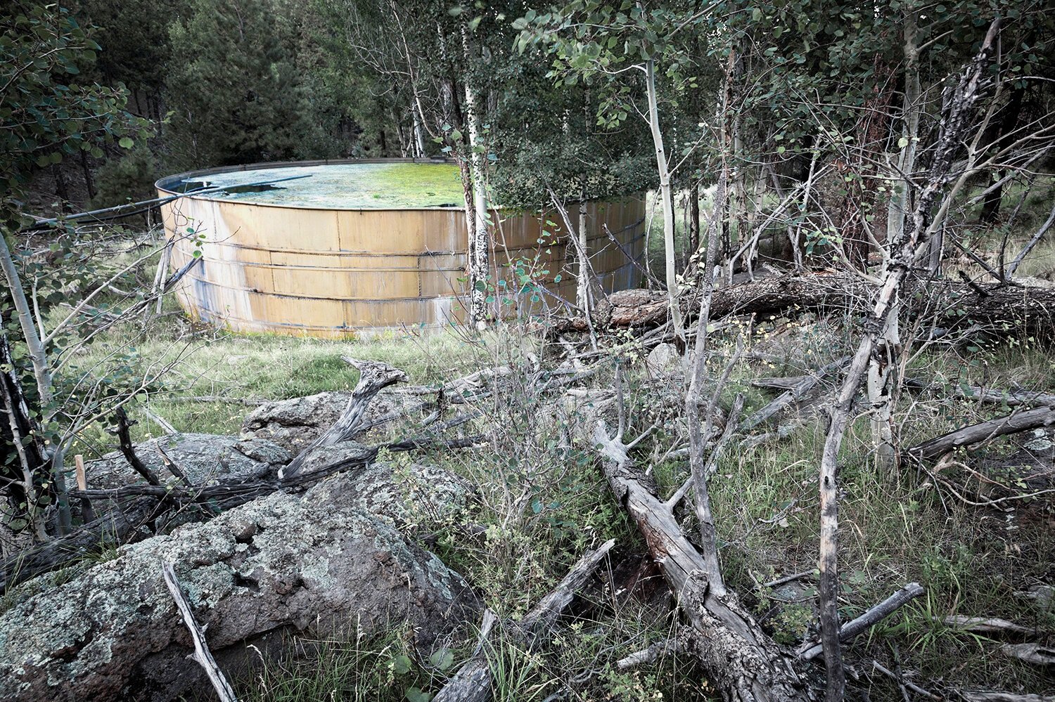
35.3408 N -111.6832 W Captured spring water storage tank, Pat Tub # 1, Colorado Plateau, AZ
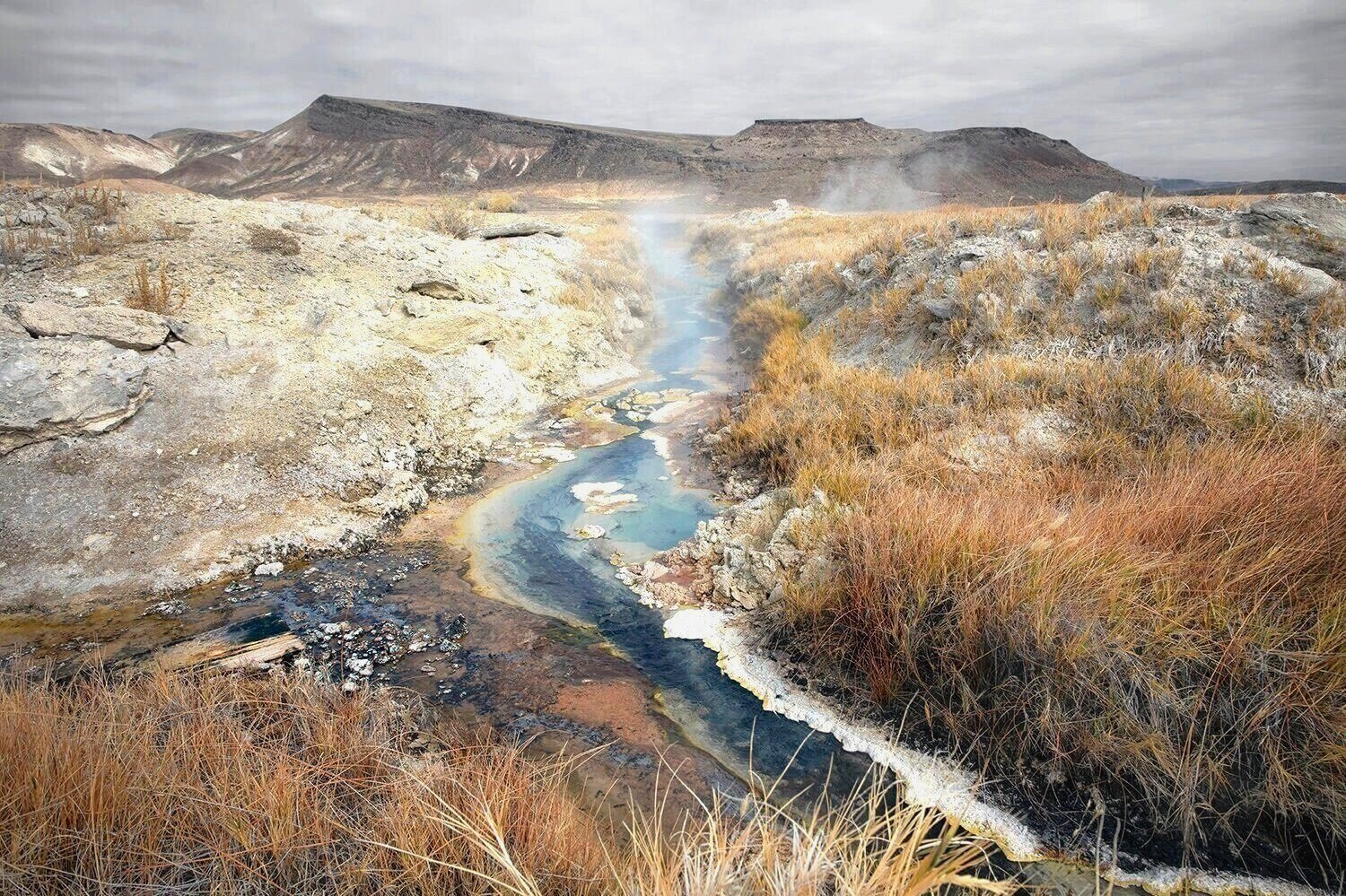
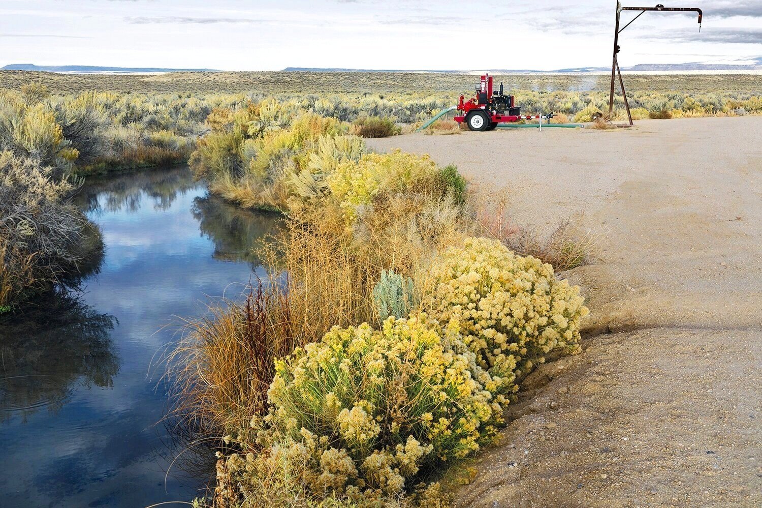
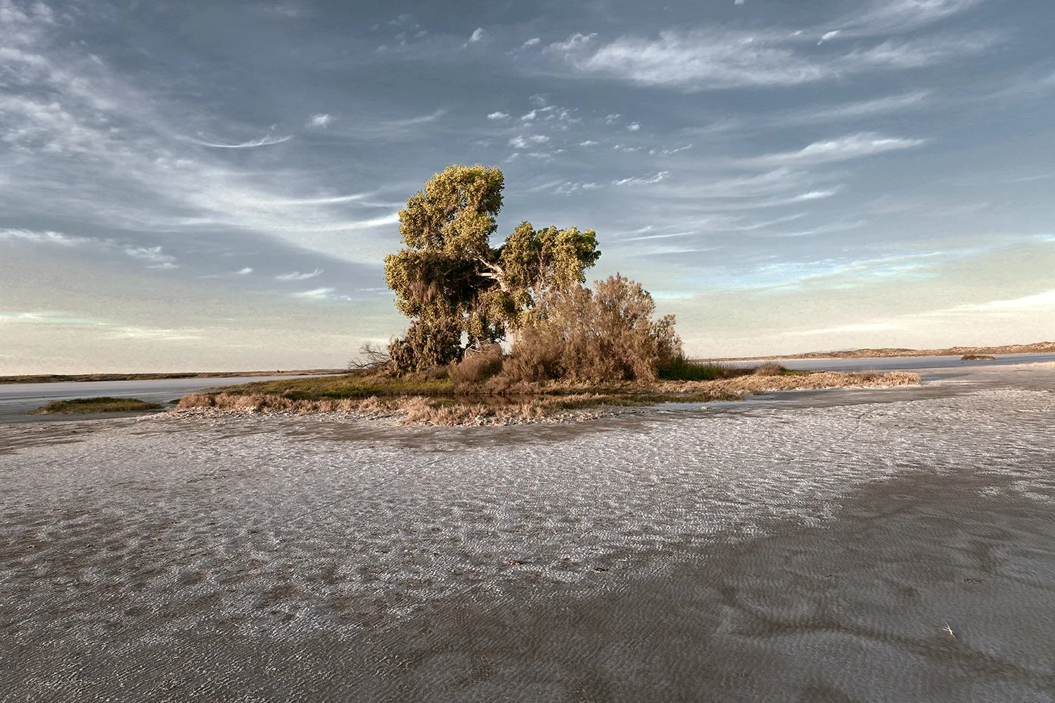
41.9238 N -118.8035 W Water-Mining at Bog Hot Springs, Black Rock Desert, NV
Agua Caliente, Sonoran Desert, Arizona
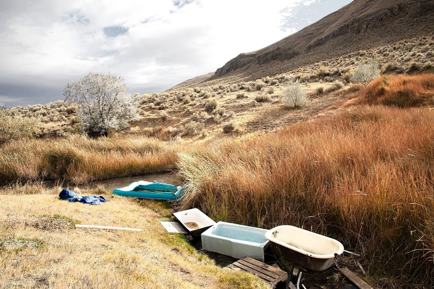
41.5674 N -118.5666 W Bath Matt with Three Bathtubs, Dyke Hot Springs, Black Rock Desert, NV
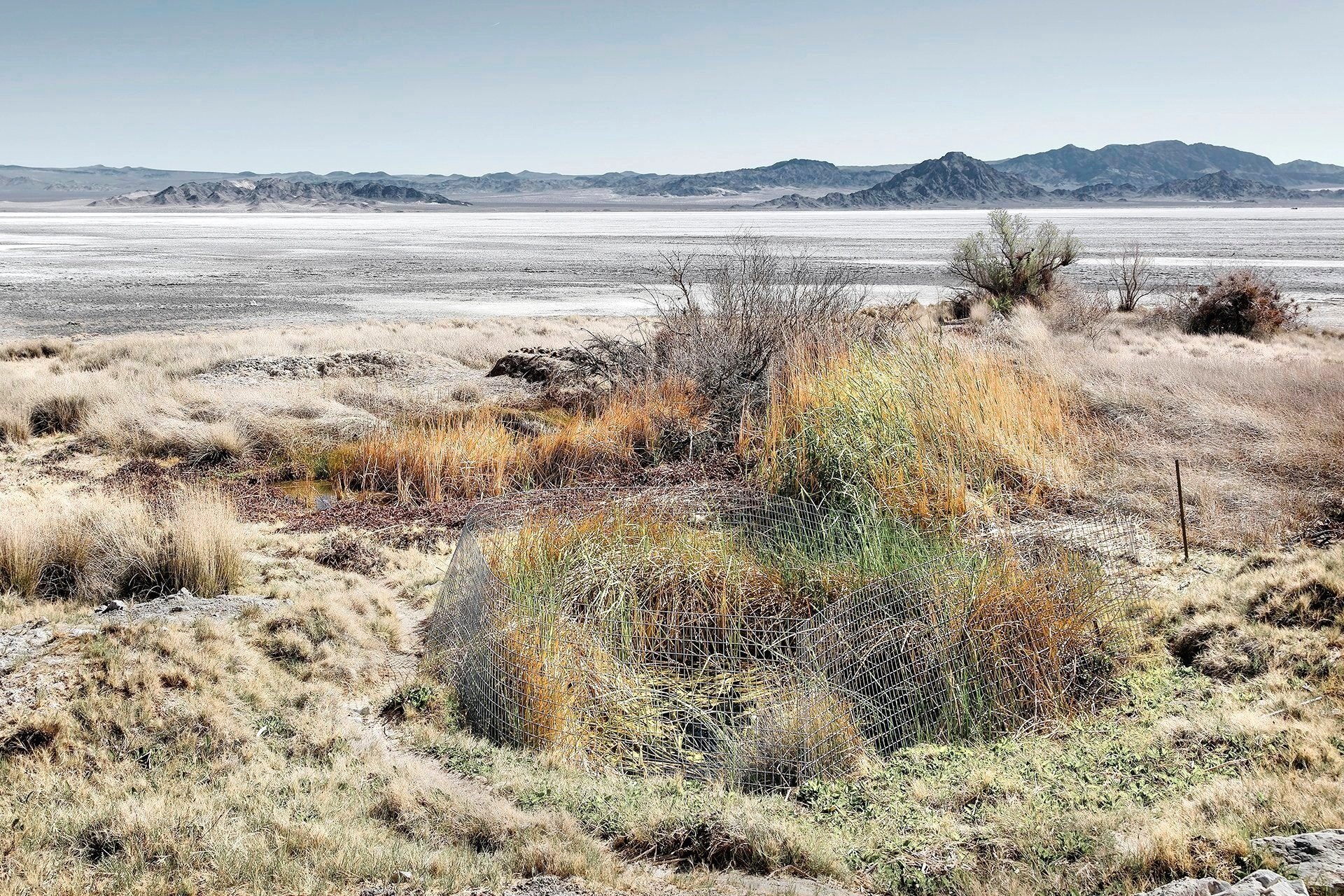
Fencing protection for the Bighorn sheep swallowing deep spring hole on the Old Spanish Trail going from Santa Fe, NM to Los Angeles, CA, MC Springs, Zzyxz, CA
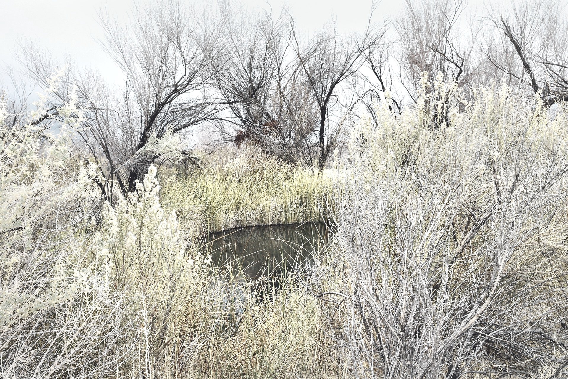
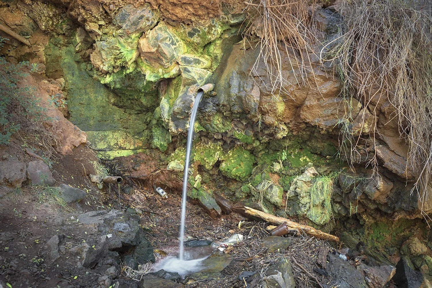
36.9085 N -115.7591 W Pipe and Board, Bryan Spring, Mojave Desert, NV
Used for at least 1,000 years, dredged and reshaped in the 1930’s by the CCC this Chihuahuan Desert oasis is on the migratory bird north/south flyway, Rattlesnake Springs, New Mexico
34.9404 N -104.6732 W Barbed wire fence Blue Hole Cienaga at Dawn, Chihuahua Desert, NM
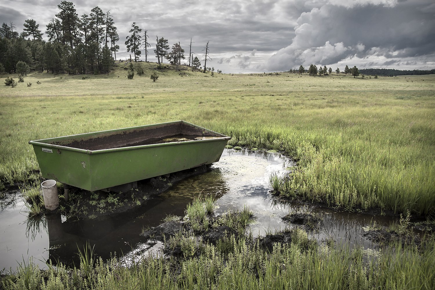
33.9256 N -109.4131 W Livestock Water Trough, Dipping Vat Springs, Sky Island Transition Zone, AZ
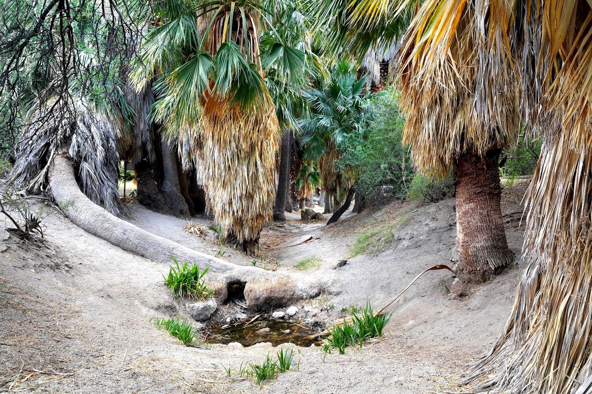
Evidence of mammoths and humans at this oasis dates back 10,000 years. Native Americans believe hot artesian waters are sacred healing sites.
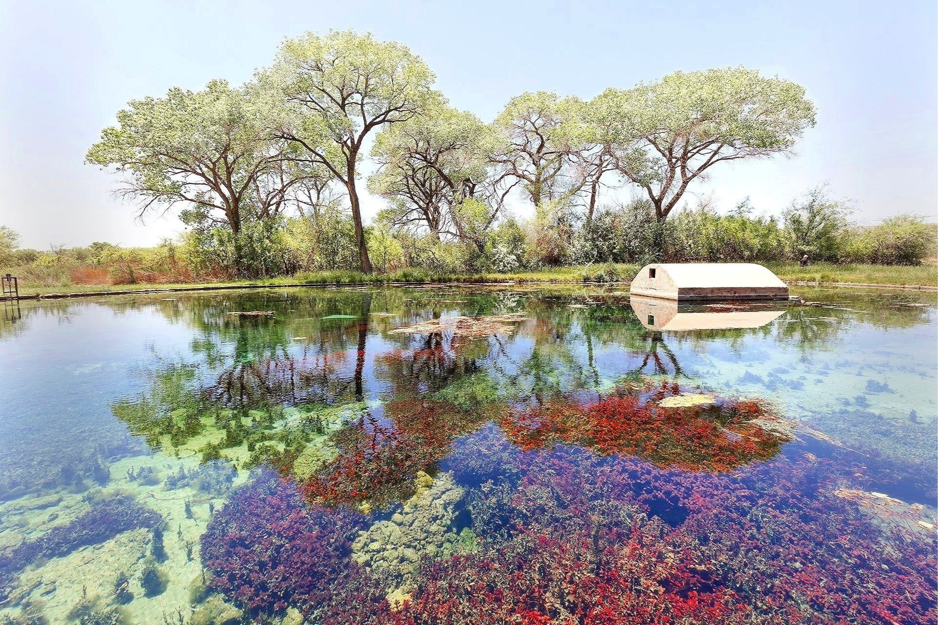
Thousand Palms Oasis, Mojave Desert, CA
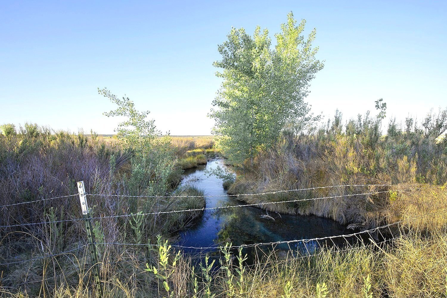
Burro Cienaga, Chihuahuan Desert, NM
37. 7510 N -111.5660 W Empty Plastic Water Troughs, Big Hollow Spring, Colorado Plateau, UT
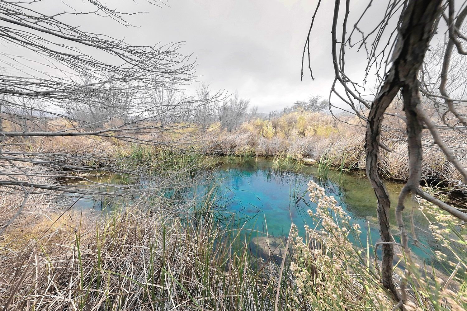
35.1822 N -111.7827 W Local Source of Running Water, Tappen Springs, on Dine, (Navajo), Land, Colorado Plateau, AZ
Corn Creek Springs, Mojave Desert, NV
The first evidence of Paleo-Indians here dates from 3,000 A.D. Later Anglo-Europeans colonists searching arid lands for a place to settle found these waters. Their over-excavation for ranching and farming put the springs in danger of extinction, causing much of the endemic wildlife to disappear. With the creation of the Refuge survival of the aquifer was assured. However, It exists within the boundaries of the U.S. Airforce's Nevada Test and Training Range. The military would like to take over most of the remaining Refuge habitat for expanded bombing exercises. With over 500 plant species, 320 bird species, 52 mammal species and over 35 reptile species and 450 recorded prehistoric sites, including numerous petroglyphs and pictographs bombing practice would destroy this unique historic area.
Unnamed spring, Gran Desierto de Altar, Sonora, Mexico
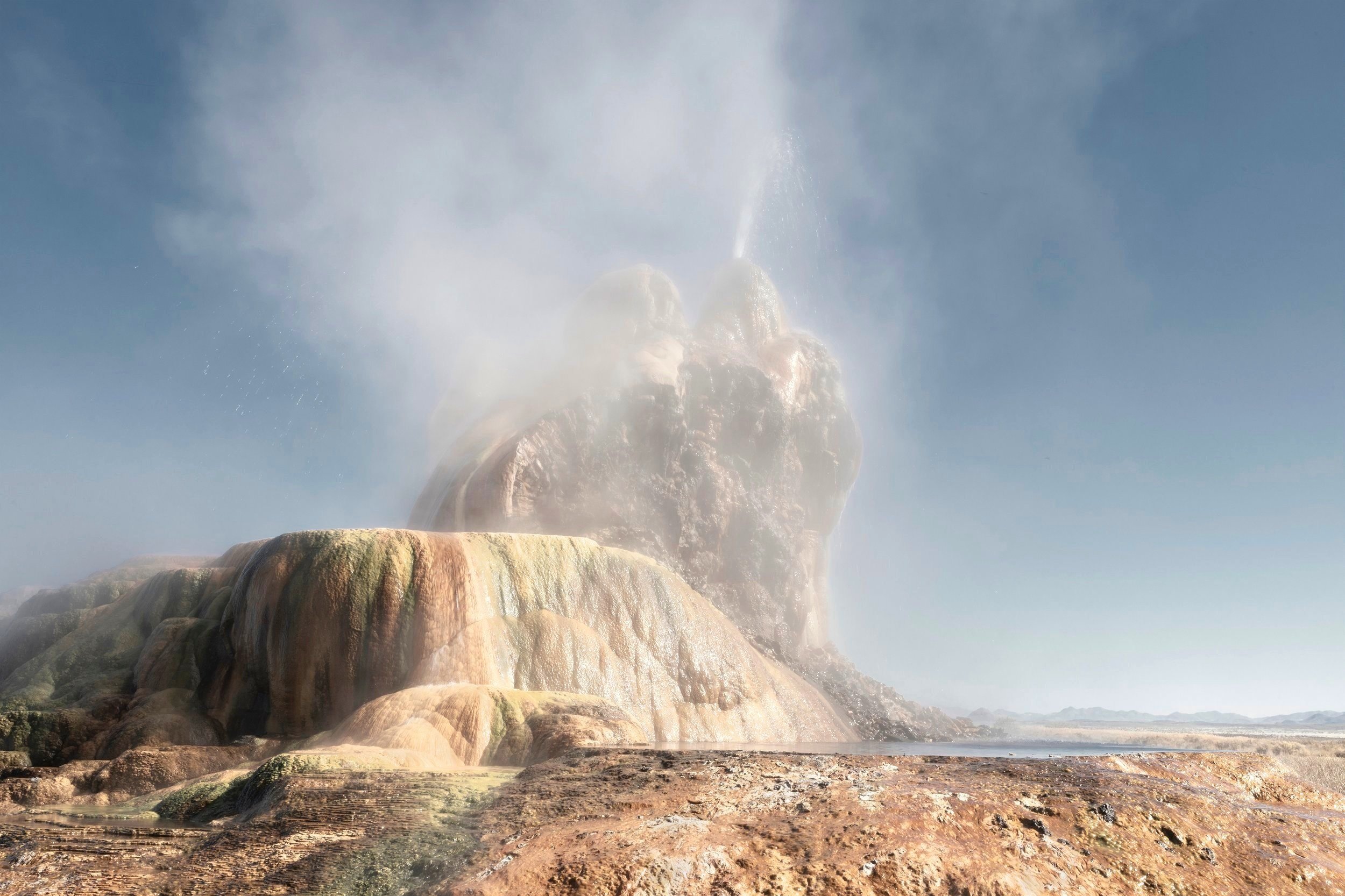
40.5134 N -119.1955 W Man-made Fly Geyser, Black Rock Desert, Nevada, U.S.
37.0737 N -116.6927 W Wild Donkey by Yellow Rabbit Brush, Wild Burro Seep, Mojave Desert, Oasis Valley, NV
31.9428 N -133.0207 W Late Afternoon near the US Border, 16,000 year Old Quitobaquito Springs, Sonoran Desert, AZ
31.5133 N -112.7511 W Plastic-lined water hole at Quitovac Springs, Sonoran Desert, MX
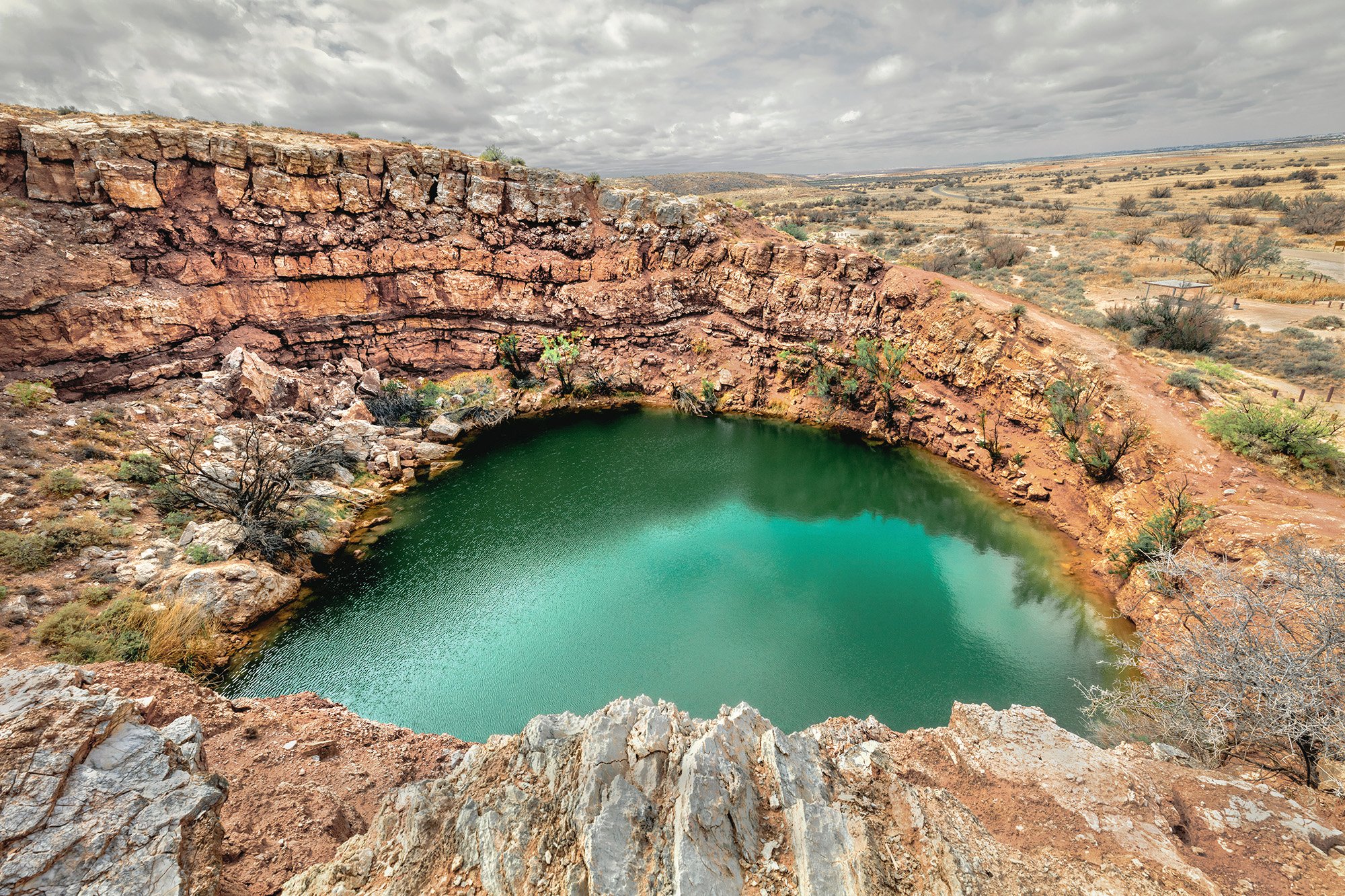
35.8550 N, -116.2309 W Water extraction borehole of last Ice-Age water located on the historic Old Spanish Trail, Tecopa Hot Spring, CA
36.3311 N -110.9249 W Last standing pipe from abandoned 1800’s trading post, water used by local ranchers. Moenave Road, Dine Nation, AZ
36.9114 N -111.4558 W Dewatered dry, Big Uncle's Spring, Colorado Plateau, AZ
37.7007 N -116.6927 W Red Water Tower at Colson Ponds, (Indian Camp) Numic/Southern Paiute Origin and Spiritual Pilgrimage Site, Oasis Valley, NV
36.4647 N -116.3237W Cattails in the Rain, Longstreet Springs, Mojave Desert, NV
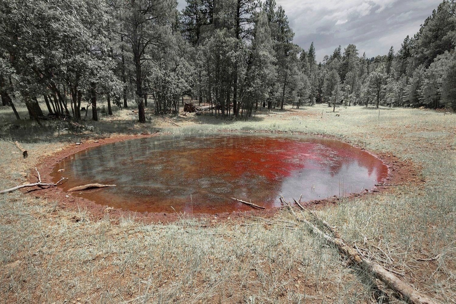
34.9736 N -111.5288 W Accidental Red Fire Retardant Airdrop, Weimer Springs, Coconino Forest, AZ
41.3566 N -118.7887 W Pinto Hot Springs, Great Basin, NV
35.3408 N -111.6832 W Captured spring water storage tank, Pat Tub # 1, Colorado Plateau, AZ
41.9238 N -118.8035 W Water-Mining at Bog Hot Springs, Black Rock Desert, NV
Agua Caliente, Sonoran Desert, Arizona
41.5674 N -118.5666 W Bath Matt with Three Bathtubs, Dyke Hot Springs, Black Rock Desert, NV
Fencing protection for the Bighorn sheep swallowing deep spring hole on the Old Spanish Trail going from Santa Fe, NM to Los Angeles, CA, MC Springs, Zzyxz, CA
36.9085 N -115.7591 W Pipe and Board, Bryan Spring, Mojave Desert, NV
Used for at least 1,000 years, dredged and reshaped in the 1930’s by the CCC this Chihuahuan Desert oasis is on the migratory bird north/south flyway, Rattlesnake Springs, New Mexico
34.9404 N -104.6732 W Barbed wire fence Blue Hole Cienaga at Dawn, Chihuahua Desert, NM
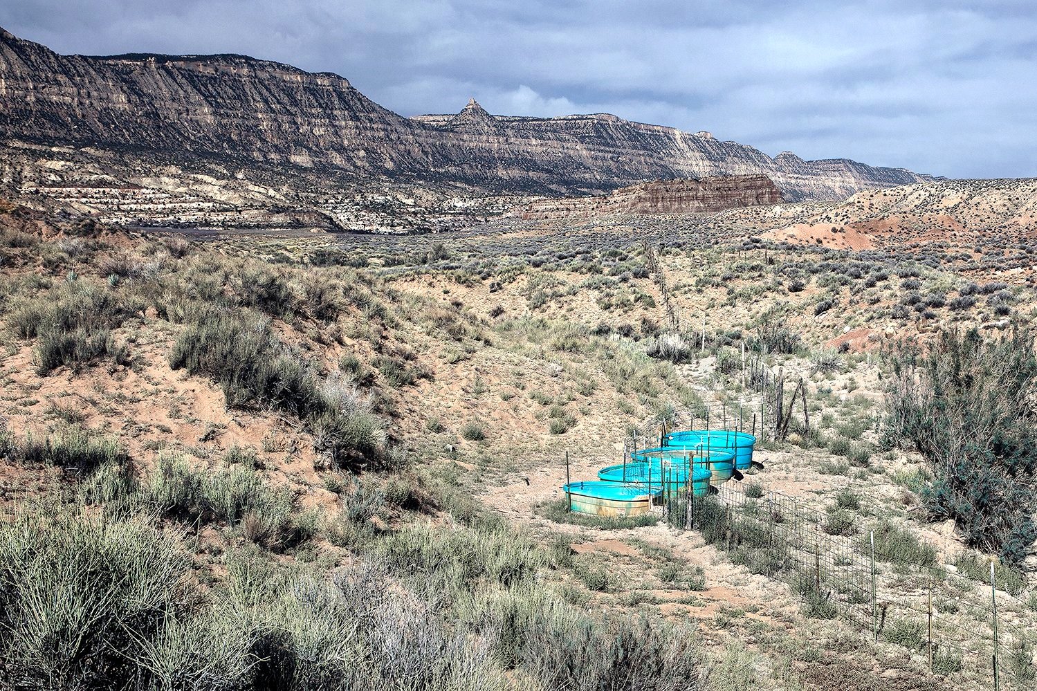
33.9256 N -109.4131 W Livestock Water Trough, Dipping Vat Springs, Sky Island Transition Zone, AZ
Evidence of mammoths and humans at this oasis dates back 10,000 years. Native Americans believe hot artesian waters are sacred healing sites.
Thousand Palms Oasis, Mojave Desert, CA
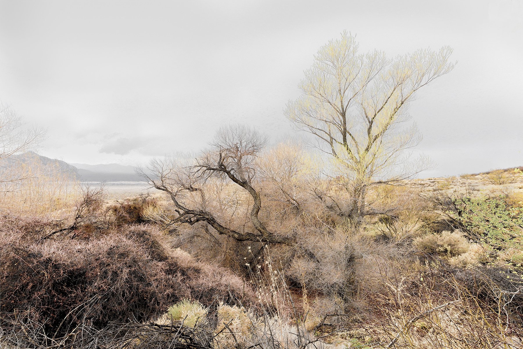
Burro Cienaga, Chihuahuan Desert, NM
37. 7510 N -111.5660 W Empty Plastic Water Troughs, Big Hollow Spring, Colorado Plateau, UT
35.1822 N -111.7827 W Local Source of Running Water, Tappen Springs, on Dine, (Navajo), Land, Colorado Plateau, AZ
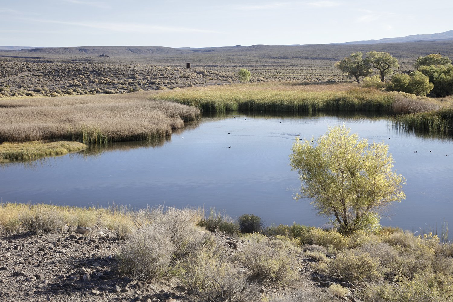
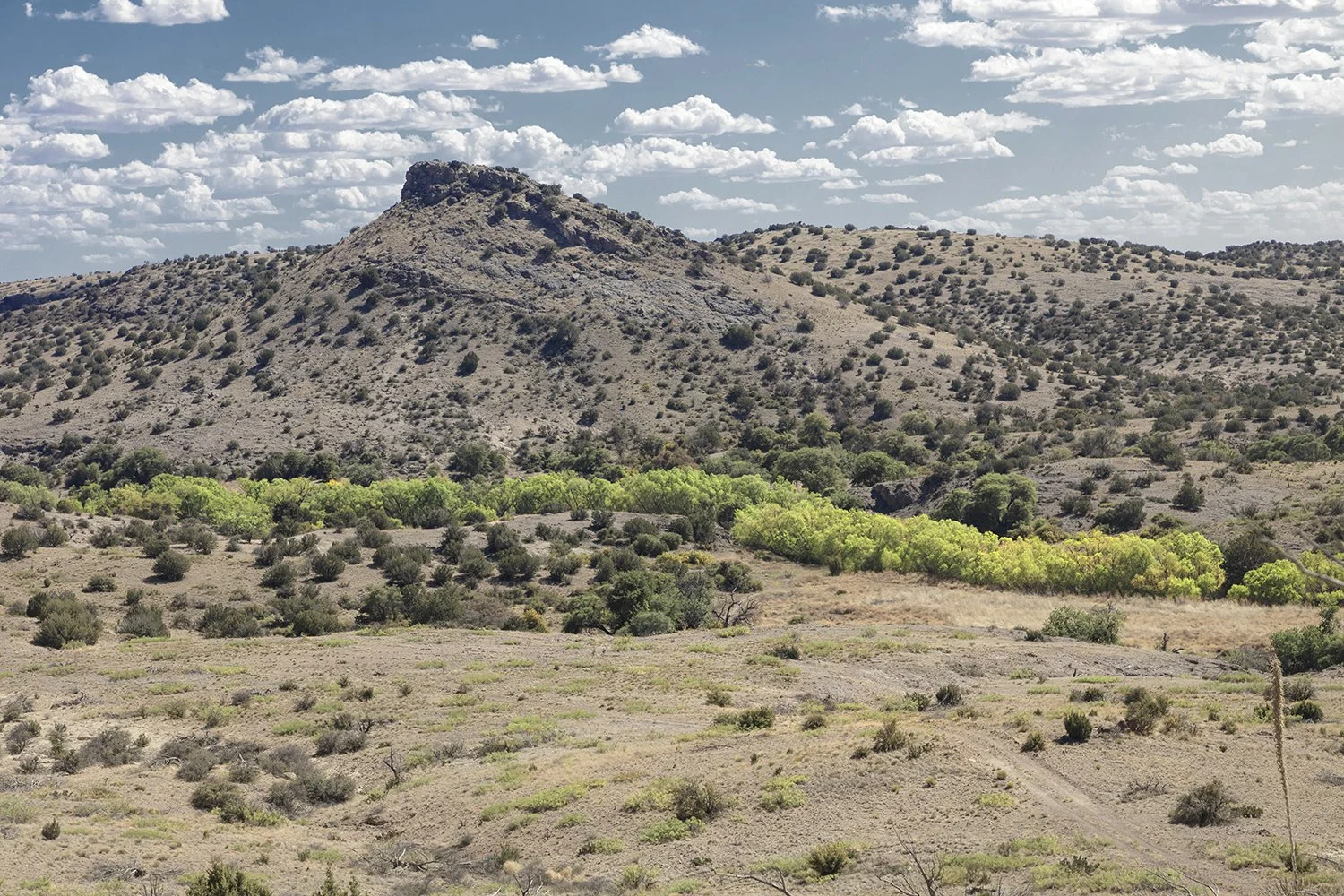
Corn Creek Springs, Mojave Desert, NV
The first evidence of Paleo-Indians here dates from 3,000 A.D. Later Anglo-Europeans colonists searching arid lands for a place to settle found these waters. Their over-excavation for ranching and farming put the springs in danger of extinction, causing much of the endemic wildlife to disappear. With the creation of the Refuge survival of the aquifer was assured. However, It exists within the boundaries of the U.S. Airforce's Nevada Test and Training Range. The military would like to take over most of the remaining Refuge habitat for expanded bombing exercises. With over 500 plant species, 320 bird species, 52 mammal species and over 35 reptile species and 450 recorded prehistoric sites, including numerous petroglyphs and pictographs bombing practice would destroy this unique historic area.
Unnamed spring, Gran Desierto de Altar, Sonora, Mexico